


Precinct 27, Tangipahoa Parish, Louisiana
About
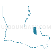
Outline

Summary
| Unique Area Identifier | 590946 |
| Name | Precinct 27 |
| County | Tangipahoa Parish |
| State | Louisiana |
| Area (square miles) | 0.77 |
| Land Area (square miles) | 0.75 |
| Water Area (square miles) | 0.02 |
| % of Land Area | 96.89 |
| % of Water Area | 3.11 |
| Latitude of the Internal Point | 30.62860610 |
| Longtitude of the Internal Point | -90.50642010 |
Maps


Graphs
Select a template below for downloading or customizing gragh for Precinct 27, Tangipahoa Parish, Louisiana


Neighbors
Neighoring Voting District (by Name) Neighboring Voting District on the Map
- Precinct 117, Tangipahoa Parish, LA
- Precinct 119, Tangipahoa Parish, LA
- Precinct 26, Tangipahoa Parish, LA
- Precinct 27A, Tangipahoa Parish, LA
- Precinct 28, Tangipahoa Parish, LA
- Precinct 28A, Tangipahoa Parish, LA